
- Elaine Philbrick
- Oct 16, 2023
- 3 min read
Updated: Apr 9, 2024

A Dark/Cold Day (sunniest trails)
O’Neil Farm (Chandler Trail)
A Wet Day (driest trails)
Avoiding Ticks (wide trail)
Off-Leash (least used)
Bay Circuit Trail between Brook Road and Vine Street
Feinberg (Camp Wing)
Temple (Camp Wing)
O’Neil Farm (Chandler Trail)

Bay Circuit Trail

3 hours of steady walking in Duxbury; road, single, and cart track; parking near 10 Brook Road or 86 Landing Road in Kingston. The only loop along the 230-mile Trail is the Duxbury/Pembroke/Kingston loop which takes 6 hours of steady walking.
Bay Farm Conservation Area

0.9 mi. loop; single and cart track; parking near 86 Landing Road, Kingston; trail through former hay field to rocky outlook over Kingston Bay with single tracks through woods.
Berrybrook & O'Neil Farms

Berry Brook
0.9 mi.; single and cart track; parking near 88 Winter St.; trail through fields and woods.
O'Neil Farm (Avery Trail)
0.8 mile partial loop; single track; parking near 349 Autumn Ave.; series of boardwalks with views of cow pasture.
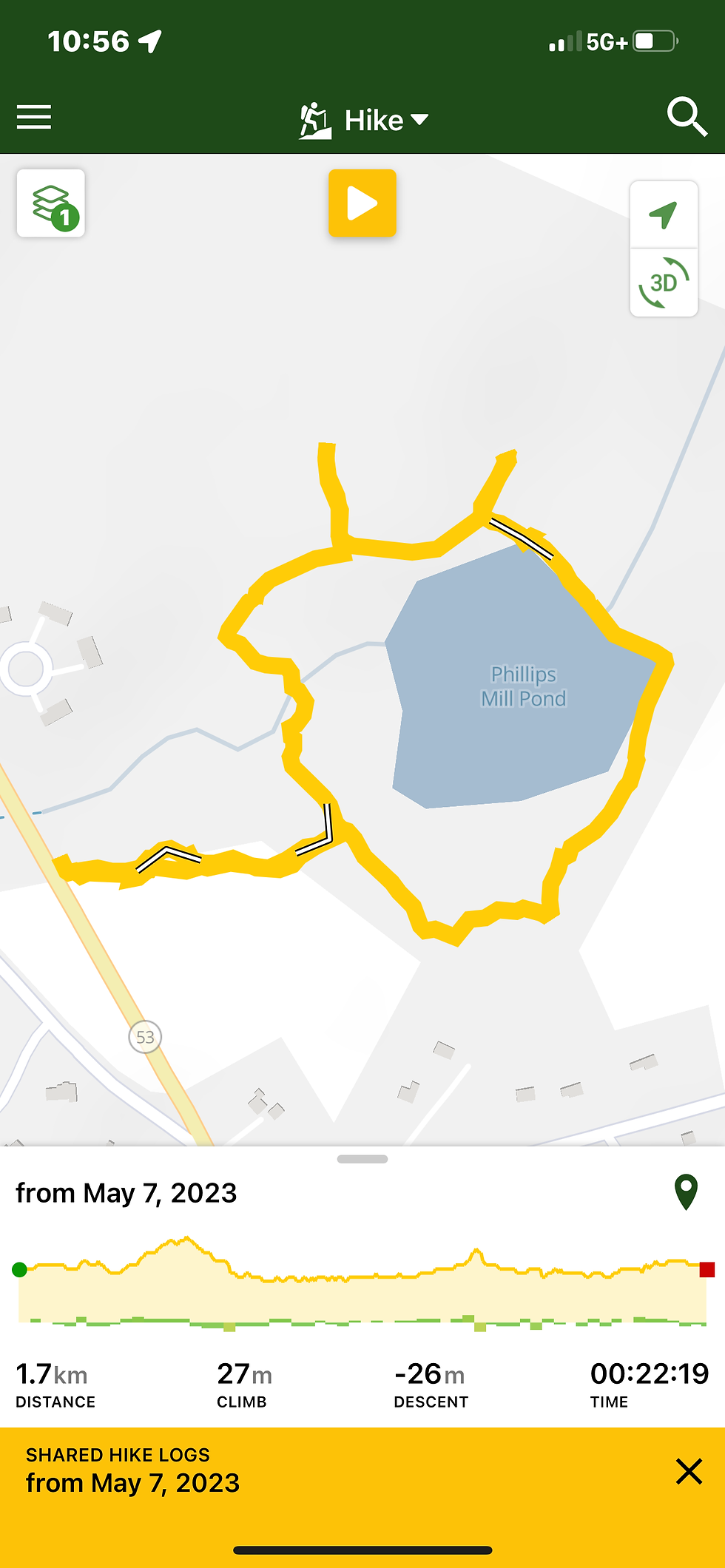
O'Neil Farm (Chandler Trail)
1.4 mi. partial loop; single and cart track; parking near 349 Autumn Ave.; sunny charming trail through farm fields and woods.
Camp Wing

Camp Wing (Feinberg)
0.7 mi. partial loop; single track; parking near 45 North St.; pleasant walk around former cranberry bogs.
Camp Wing (Franklin St.)
1.5 mi. loop; single and cart track; parking near 615 Franklin St.; parts boggy when wet, has spurs off Freeman (yellow) trail to bench beside creek and bench overlooking marsh.
Camp Wing (Temple St.)
0.6 mi. loop; single track; parking near 977 Temple St.; charming dry winding trail beside swampy creek enjoyed by geese.
Duxbury Beach
4 mi. beach sand track; parking near 435 Gurnet Road; wide sandbar beach with the Atlantic Ocean on one side and Duxbury/Kingston/Plymouth Bay on the other.
East Street Bogs

1.9 mi. loop; single and cart track; parking near 182 East St. and between 831 and 907 Mayflower St.; cranberry bog trails with single track through woods.
Gifford Bog/Wright Reservoir

1.8 mi. loop; single and cart track; parking near 60 Millbrook Way; trails through bog, woods, power line, around the reservoir.
Lansing Bennett (Summer Street)
1.9 mi. loop; single and cart track; parking near 182 East St. and between 831 and 907 Mayflower St.; cranberry bog trails with single track through woods.
Lansing Bennett Forest (Trout Farm)

1.5 mi. loop; single track; parking near 180 Union Bridge Rd.; woods trail with boardwalk along stream.
Lansing Bennett (Waiting Hill Preserve)
3.2 mi. loop; single and cart track; parking near 25 Lincoln St.; woods trail along a pond. (On Round Pond/North Hill map follow green trail to Modoc Street, then red trail to #5 blue trail along west side of pond, then #1 yellow trail back to #6 green.)
North Hill Marsh and Round Pond Conservation Areas

North Hill
3.3 mi. loop; single track; parking near 307 Mayflower St.; trails through woods around pond.
Round Pond
1.9 mi. loop; single and cart track; parking near 307 Mayflower St.; trails through woods around pond.
Thaddeus Chandler

1.3 mi. loop; single and cart track; parking near 118 Valley St.; trails through bogs and woods with pond view.
Whiton Woods

1.2 mi. loop; single and cart track; parking near 663 Temple St.; dry (except for one spot) winding trail with views of cranberry bog, stream, and do a short walk off blue trail on other side of bog to view the Marshfield Country Club course.


Comments